Vegitation and GDP in Malawi
For my thesis project at Parsons School of Design in 2018, I had the incredible opportunity to work with the UNDP for Sub Saharan Africa to develop an analysis of vegetation changes in Malawi, Africa.
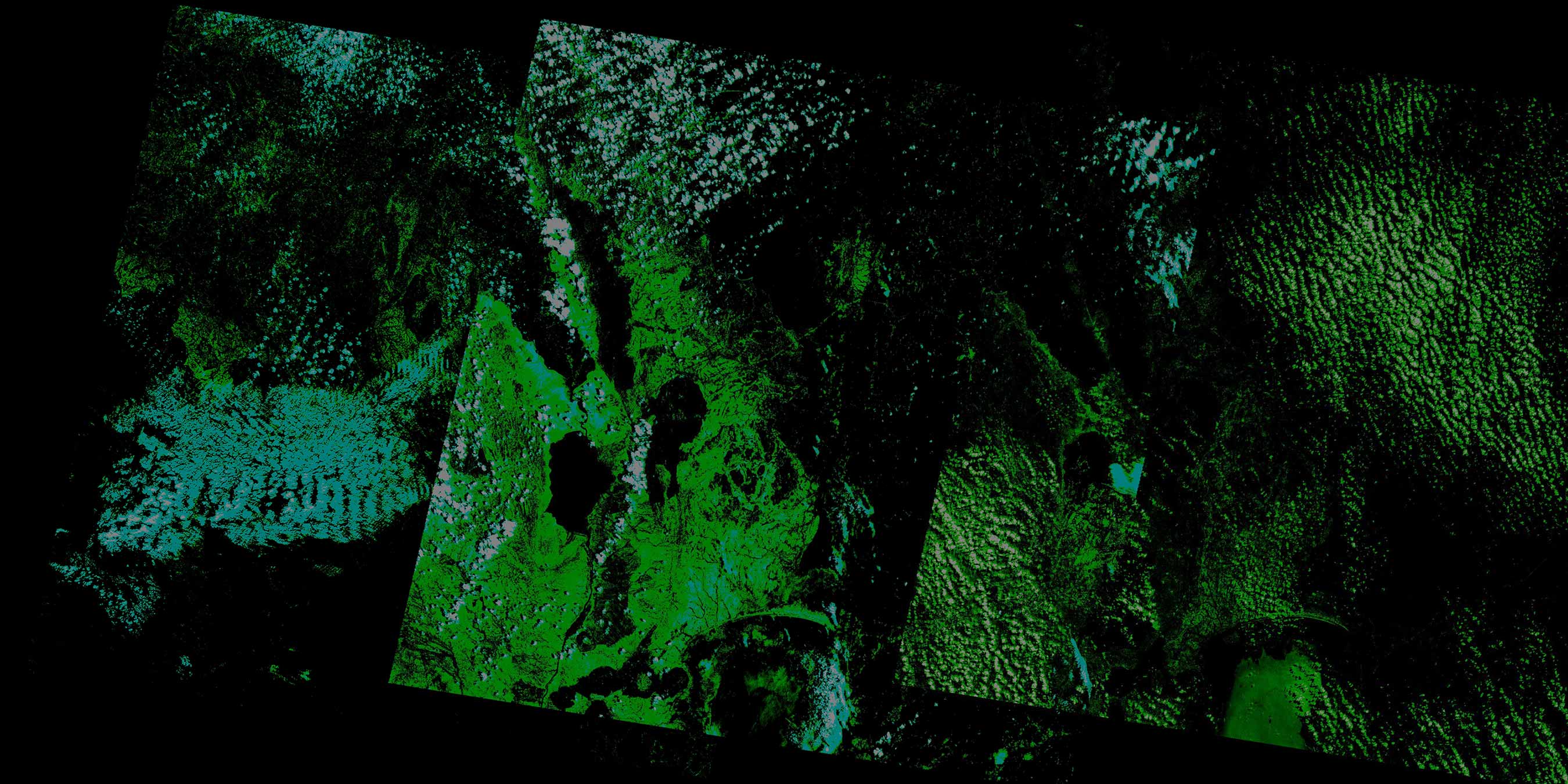
I approached this project from a couple of different technical angles. First, as you can see in the above image, I wrote a python script to process and analyze satellite images. Take a look at some of my code on GitHub. Additionally I used d3.js and JavaScript within Google Earth Engine to study changes over time as can be seen here.
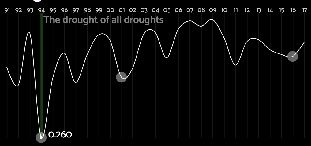
The most incredible moment of my collaboration with the UNDP was when I showed this piece to the Chief Economist and he pointed out the cause of one of my vegetation/gdp dips: A major drought in the 90's - "The Drought of all Droughts."